Christian Champagne
Elementy, w których Christian Champagne attends
poniedziałek 6 listopada, 2023
Step into the exciting realm of the inaugural GoGeomatics Expo in Calgary, a historic event that is set to make waves in Canada's geospatial sector. This compelling panel discussion will delve into the groundbreaking significance of this first-of-its-kind expo, exploring why it is a game-changer for both the public and private sectors, and how it charts a new course for the geospatial industry in Canada. This panel discussion takes place after the expo reception buffet. Participants must b...
wtorek 7 listopada, 2023
This is where Canada’s geomatics sector is meeting for a show that will span manufacturers, service and data providers, professionals, academics, and thought leaders in the Canadian geospatial sector. Positioned in Calgary, Alberta, in the heart of Canada’s geomatics sector, this is an annual event where companies in geomatics will do business and meet new partners, and the sharpest innovators will be there.This expo is hosted by GoGeomatics Canada in consultation with our industry,...
The Expo proudly showcases the Canadian Cartographic Association Student Map Competition.Discover the recipients of the Best Student Presentation & President’s Prizes in thematic map design showcased at the map gallery on the trade show floor.Entries include: President’s Prize (College Level Entries)Jessica Murdoch ...
Student posters will be available for viewing in the Expo Gallery November 7th and 8th. Authors will present a brief summary of their poster and will be available for questions on Tuesday, November 7th from 2-4 pm.
Since 2018, students from geomatics programs across Canada have been participating in the annual National Geomatics Competition. Now in it's 5th year, the University of Sherbrooke will be hosting the next iteration in March.We invite you to participate in this discussion around the opportunity for industry and academia to meet at NGC 2024.
Over the past three decades, global and national economies have undergone profound transition while the governments that have tried to steer worldwide growth have been buffeted by profound changes in how citizens interact and feel about the level of services they receive. That many of them are more empowered than ever by social media, which is often said to have hastened the growth of significant divides, speaks to the need of many governmental leader to stay in touch with prevailing th...
SUMMARYWith the increasing focus on damage prevention, public safety concerns, and environmental damage due to underground utility strikes, it has become more critical to accurately locate, store, and be able to visualize subsurface utilities. We show several key technical and business details when implementing a subsurface mapping system from data collection to the use of machine learning for 3D modelling and visualization and give real-world examples and use cases of the different le...
What are the trends in education, technology, policy, perception and markets that will mold the future of Geomatics – and how has the profession responded? The presenter has worked in and written about numerous aspects of surveying for several decades and views the future of the profession as one of both challenges and opportunity – new, exciting and sometimes surprising opportunities. This session will be interactive, challenge conventional wisdom, poke a little fun, and hopefully provides s...
At the Earth Observation for the Environment Laboratory in The University of Calgary, we have been conducting research in developing remote sensing-based forecasting system for forest fire danger conditions since 2009. In the scope of this presentation, the chronology of such developments at daily, 4-day, and 8-day time scales will be discussed. We believe that these would be critical for managing forest fire regimes in Canada and elsewhere in the world.
With climate change comes a massively increased risk to billions of people due to disasters, reduced food and energy security, environmental degradation, and sea level rise to name a few. For example, it is estimated that 200,000,000 people live in low-lying areas of the world considered highly vulnerable.The global OGC community has mobilized to improve how well we connect land, sea, and air Geospatial data and information, improve regional connectivity between various SDIS &nbs...
In February 2022, Balko Technologies, a Quebec-based company, launched the world's first modular drone Lidar, which aims to democratize geospatial data capture by offering a versatile, easy-to-use and quick to deploy solution. This technological showcase aims to demonstrate the performance, modularity and distinctive advantages for users of our brand new Connectiv solution and its e-LAS software, developed by a team of experts with more than 10 years of experience in airborne data capture....
LiDAR continues to be a cornerstone of the mapping industry. Since its inception, the technology has evolved from sole use on manned aircraft to being used on UAVs and mobile mapping platforms. As the LiDAR industry continues to evolve, our panel of experts will discuss what current and future trends impacting this industry. Join our award-winning panelists for an exciting discussion. Bring your questions.
In the face of escalating environmental challenges, Canada grapples with the urgent need for advanced solutions in wildfire monitoring, emissions reduction, and natural resource management. This panel discussion explores how the burgeoning "New Space" frontier offers innovative approaches to address these critical issues.We aim to provide a platform for various industry players to share their own innovative technologies and insights, creating a vibrant dialogue on crucial geospatial...
Geodetic Reference Systems are the foundation for geospatial data, serving as the official reference for latitude, longitude, height and gravity in Canada. There are many contributors to providing such standards to Canadians, including Federal, Provincial and Municipal governments, the private sector, academia, and others. Users will know that every few years there are new versions introduced of the datums or reference frames. A change in reference system, however, invo...
Menu - Big Four OutletAppetizersRoasted Diablo Pork Bites (12) (GF/DF) SaladsSpiced Cauliflower, Chickpea & Tofu Bowl (GF/DF/V/VE) Sweet Potato, Roasted Cauliflower, Chickpeas, Mint Chutney,Grilled Tofu, Madras Curry DressingClassi...
Join us for an immersive and interactive workshop led by the founder of Cyanic Automation, Doug Kondor. In this engaging session, you'll delve into the world of project management in the context of land surveying, guided by an industry expert with a passion for innovation.Workshop Highlights:Theory Meets Practice:Doug Kondor goes beyond theory, offering a hands-on journey through the best practices of project management. Learn how to bridge ...
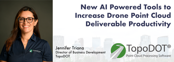
Learn how newly implemented surface modeling tools employing artificial intelligence reduce the turnaround time of point cloud surface models by 400% while maintaining high-fidelity results around break lines. Faster ground extraction routines for UAV data can be achieved without the need for classification or noise removal. In this presentation, we'll discuss several examples including how a query volume calculation project compared with traditional modeling workflows yielded nearly exact...
The end of the first day of the National Canadian GoGeomatics Expo is being marked by a lively party that is eagerly anticipated by all participants. The party is being held on the floor of the tradeshow in a venue that hosts many of the best rock concerts and shows for the Calgary Stampede. It promises to be a lot of fun, with an atmosphere buzzing with excitement and energy as attendees mingle, network, and celebrate the end of a successful day.The party is made even better by the in...
środa 8 listopada, 2023
This is where Canada’s geomatics sector is meeting for a show that will span manufacturers, service and data providers, professionals, academics, and thought leaders in the Canadian geospatial sector. Positioned in Calgary, Alberta, in the heart of Canada’s geomatics sector, this is an annual event where companies in geomatics will do business and meet new partners, and the sharpest innovators will be there.This expo is hosted by GoG...
Join us at the Calgary GoGeomatics Expo for an exclusive workshop hosted by Jonathan Murphy, the founder of GoGeomatics and GeoIgnite. In this session, you'll discover the opportunites to successful marketing with GoGeomatics and explore the vibrant world of the GoGeomatics community. Workshop Highlights:Marketing with GoGeomatics: Dive into the art of geospatial marketing with one of the industry's leading experts. Jonathan Murphy will guide yo...
Join us at the GoGeomatics Expo for a dynamic panel discussion on the latest trends in Lidar technology. Our panel of experts will dive into the advancements in Lidar data, hardware, and software, providing valuable insights into the ever-evolving geospatial world. Discover the future of Lidar and its applications, and stay at the forefront of geomatics innovation.lidarcanex.com
Great Leadership is central to our Industry – leaders that are adeptly able to connect and interoperate with business, government, and institutional entities. While traditional hub-and-spoke leadership structures remain, a wave of agile, resilient, and dynamic leaders are stepping up. But organizations aren’t made up simply of leaders. In our quest for the best leadership, have we overlooked or forgotten about the skills, resources, and commitment to developing and empoweri...
Rapid, short-range data collection will only become more critical as the technological revolution continues. From planning and analytics to VDC and BIM, to Safety, Security, Project, and Facilities management, the applications for reality capture technology is only going to increase as industry calls for cost savings, awareness, accountability, and efficiency. In this climate, Simultaneous Localization and Mapping (SLAM) platforms are emerging as the solution that can meet the needs of ind...
This panel will delve into some Geoff Zeiss's favorite topics:Example - Colorado DOT, PennDOT. Not an explicit requirement but required for permitting in their RoW’s – effectively a regulatory standard. Metrolink Regulation1: Business Case for SUE DataASCE – Not a regulatory requirement but a recommendation.Regulate on Backend – Permitting Process requirement for ASCE Benefits of Accurate Data2: Standards
The talk presents how multi-band SARs (X-band Iceye, C-band RADARSAT-2 and L-band SAOCOM) support various earth observation applications, such as target identification, change and displacement detection, and soil moisture map generation. Furthermore, it presents MDA's next-generation Chorus constellation (combination of C-band and X-band SARs).
The SLAM Scan-off results are in, but what does that mean, where can this technology be applied, and what technology can be applied to it?Join us for a discussion following the results of the GoGeomatics SLAM Scan-Off:- The strengths and weaknesses of adopting SLAM platforms into your workflow.- The appropriateness of SLAM platforms for specific uses.- The compatibility of SLAM platforms with downstream tools and methods.- The current and possible futures of SLAM sys...
As part of the annual Canadian Expo program, GoGeomatics will be looking to recognize and award individuals and companies that have shown top-level leadership, innovation and forward thinking in the geomatics field. We will establish several categories of awards. The first set for activities at the Expo this year and the second set for next year allowing the community to participate by nominating awardees to be considered.Awards Presented at this year's Expo:Geo...
Menu - Big Four OutletAppetizersRoasted Diablo Pork Bites (12) (GF/DF) SaladsSpiced Cauliflower, Chickpea & Tofu Bowl (GF/DF/V/VE) Sweet Potato, Roasted Cauliflower, Chickpeas, Mint Chutney,Grilled Tofu, Madras Curry DressingClassi...
Research Presentation:Airborne Topo-Bathymetric Lidar Combined with Thermal Imaging for Fish Habitat Studies in RiversResearchers at Nova Scotia Community College’s Applied Geomatics Research Group have been using the airborne Leica Chiroptera 4X topo-bathymetric lidar sensor for nearly a decade and have surveyed coastal, riverine and lake environments. They have concentrated on mapping submerged aquatic vegetation (SAV). Topo-bathy lidar data of rivers provides an opportu...
Join us at the GoGeomatics Expo for an insightful panel discussion that tackles the pressing question: Where will the next generation of land surveyors emerge from? Our panel, featuring experienced educators and professional land surveyors, will engage in a thought-provoking dialogue on strategies and solutions to attract and nurture the future leaders of the land surveying profession. Don't miss this opportunity to gain valuable perspectives on the future of land surveying.
wtorek 26 marca, 2024
The Canadian government first formally created LiDAR Guidelines in 2017. The document was updated in 2022 to Version 3.1. This session will review the Canadian Guidelines and compare them to the USGS LiDAR Base specification, updated in 2023. Included in the presentation will be:LiDAR for Flood Mapping and funding from the National D...
As traditional infrastructure design methods migrate from 2D to 3D modeling, LiDAR data acquisition continues to present an opportunity to improve the base modeling process. This presentation will show how TopoDOT can be used to extract DGN vector data from point clouds to improve the quality of digital as-built base models which enable better transportation 3D design processes like Bentley’s ORD.
środa 27 marca, 2024
The United States’ National Geodetic Survey (NGS) plans to modernize their National Spatial Reference System (NSRS) in 2025, including adopting a new dynamic geometric reference (the North American Terrestrial Reference Frame of 2022 (NATRF2022)) and a new geoid-based height system (the North American-Pacific Geopotential Datum of 2022 (NAPGD2022)). To ensure continued geospatial referencing compatibility, the Canadian Geodetic Survey (CGS) plans to modernize the Canadian Spatial Reference Sy...


