Patrick Eglinton
Elementy, w których Patrick Eglinton attends
wtorek 26 marca, 2024
Airborne Topo-Bathymetric Lidar Combined with Thermal Imaging for Fish Habitat Studies in RiversResearchers at Nova Scotia Community College’s Applied Geomatics Research Group have been using the airborne Leica Chiroptera 4X topo-bathymetric lidar sensor for nearly a decade and have surveyed coastal, riverine and lake environments. They have concentrated on mapping submerged aquatic vegetation (SAV). Topo-bathy lidar data of rivers provides an opportunity for improved flood hazard h...
środa 27 marca, 2024
The United States’ National Geodetic Survey (NGS) plans to modernize their National Spatial Reference System (NSRS) in 2025, including adopting a new dynamic geometric reference (the North American Terrestrial Reference Frame of 2022 (NATRF2022)) and a new geoid-based height system (the North American-Pacific Geopotential Datum of 2022 (NAPGD2022)). To ensure continued geospatial referencing compatibility, the Canadian Geodetic Survey (CGS) plans to modernize the Canadian Spatial Reference Sy...
wtorek 14 maja, 2024
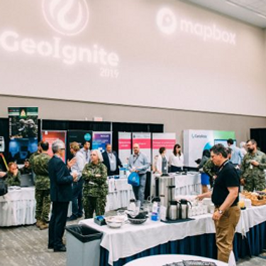
Mini Continental BreakfastGeoIgnite is delighted to offer a selection of chilled fruit juices, freshly baked croissants, muffins, and breakfast pastries, served with butter and preserves. Guests can also enjoy fruit cocktails and yogurt. Available beverages include coffee, tea, and decaffeinated coffee.
GeoIgnite is thrilled to present its keynote session, "Canada's Geospatial Leadership Panel," a gathering of some of Canada's most influential figures in the field of geospatial technology in Canada. Panelist: Melanie Desjardins, Director of the NWT Centre for Geomatics, showcases the application of geospatial technology in public sector management and natural resource governance. Her leadership in geomatics plays a significant role in shaping policies and strategies that utilize ...
In today's rapidly advancing technological environment, the imperative for robust digital governance has never been more critical. The rapid increase of digital technologies and data has underscored an necessity for standardized governance frameworks that not only bolster security and trust but also ensure innovation and efficiency across diverse global systems. This presentation will delve into the paramount importance of establishing and adhering to consensus-based standards in ...
Following the definition set out in the United Kingdom by Digital Built Britain, we understand a digital twin to be “...a realistic digital representation of assets, processes or systems in the built or natural environment…that adds social and economic value by augmenting the decision-making process.” Further, this digital representation has the capacity to exchange real time information with its physical twin and to use that information to learn, predict, or enact a possible response to a gi...
Monitoring large numbers of activities and assets from space has long been an aspirational “holy grail” for satellite remote sensing. However, lack of observational cadence, collection capacity, sufficient resolution, multisource capabilities and contextual understanding of monitored sites has meant that true monitoring has been limited to a handful of key facilities and mission use cases. Will we as an industry be able to overcome current challenges and turn site monitoring into a mainstream...
Day 1 Lunch Buffet MenuIndulge in a vibrant selection at our buffet, featuring a house blend of baby spinach, kale, and mesclun greens tossed with feta cheese, a custom blend of seeds, dried cranberries, and golden raisins. Savor the exotic flavors of curried couscous with raisins, freshly made...
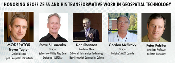
In the upcoming Canada's National Geospatial Conference, we are delighted to host a special plenary session, "Mapping the Future: Honoring Geoff Zeiss and His Transformative Work in Geospatial Technology," on May 14th in Ottawa. This session is dedicated to celebrating the remarkable contributions of Geoff Zeiss to the fields of mapping, utilities, and Geographic Information Systems (GIS).Geoff Zeiss, renowned for his insightful blog...
środa 15 maja, 2024
Mini Continental BreakfastGeoIgnite is delighted to offer a selection of chilled fruit juices, freshly baked croissants, muffins, and breakfast pastries, served with butter and preserves. Guests can also enjoy fruit cocktails and yogurt. Available beverages include coffee, tea, and decaffeinated coffee.
The domains of BIM and GIS have historically been separate areas of expertise and been considered distinct and separate domains. However, the need for geospatial technologies to integrate with Building Information Modeling (BIM) design applications and the need for BIM geometry and data to be applied in Geographic Information Systems (GIS) is becoming more prevalent. In the rapidly evolving period of urban development, BIM and GIS emerge as pivotal technology tools shaping the future of...
The Carleton University Immersive Media Studio (CIMS) was awarded a New Frontiers in Research Fund (NFRF) Exploration program grant to Imagine Canada’s Digital Twin. One aspect of the project is data governance and business models. In addition, the I Trust AI research SSHRC funded project based out of UBC, is examining the CIMS and city of Ottawa Digital Twins to assess how their creators might include preservation in their design. These research projects revealed that the Architecture, Engin...
The Department of National Defence, as steward of a real property (RP) portfolio that includes tens of thousands of buildings and supporting infrastructure, is seeking to manage its Real Property (RP) assets more effectively by modernizing and improving its digital capability. In this effort, interoperability between BIM and GIS through open data standards is crucial to enable the Integrated Digital Built Environment. BIM allows representation of detailed information regarding building elemen...
Simplify your AI infrastructure and reduce your interoperability headaches with TileDB, the adaptive database for geospatial AI.The need for geospatial insights with AI requires the management and ETL of legacy geospatial data lakes. Learn how TileDB can model all data as n-dimensional arrays as it sees no data as unstructured. TileDB is multi-modal and supports rasters, point clouds and geometries with a single API.We will explain that TileDB is ideal for Generative AI with geo...
GeoIgnite is proud to present a vital panel discussion titled "Bridging Worlds: Integrating BIM and GIS for a Digital Future in Built Asset Management," featuring distinguished panelists Susan Keenliside, Deputy Director at the House of Commons of Canada, and John Hale, Vice-President of buildingSMART Canada and BIM lead at the Department of National Defence. The session will be moderated by Trevor Taylor of the Open Geospatial Consortium (OGC).
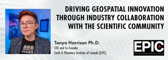
The Earth observation (EO) sector has struggled to break outside its own space echo chamber to have its full potential realised for both social and economic benefit. Can better collaboration between industry and the scientific community help to unlock this potential and drive geospatial innovation? Dr. Tanya Harrison, Co-Founder and CEO of the Earth and Planetary Institute of Canada (EPIC), will highlight examples of such collaborations that have led to breakthroughs that enhanced both indust...
Day 2 Day Lunch Buffet MenuOn the final day of GeoIgnite, enjoy an exquisite lunch buffet featuring artisanal garlic focaccia and a classic Caesar salad, with croutons and bacon bits served on the side. Relish a medley of olives and marinated mushrooms. Savor lightly breaded chicken breast glazed in a tomato and basil sauce, topped with ...
buildingSMART and the Open Geospatial Consortium have recently published the results of their collaborative effort aimed at developing a joint roadmap toward seamless information continuity between BIM and GIS domains. This session will provide insights regarding this collaborative effort and the joint roadmap between both organizations, which aims to enhance alignment between the two industry bodies on this critical subject. Discover how this roadmap has been crafted to capitalize on global ...
The presentation will be focused on the deployment of technological processes on the Centre Block Rehabilitation project and illustrate how the team is managing and manipulating different forms of asset element data for distribution and coordination among an exceptionally large subset of stakeholders, each with their own complex set of requirements and governance policies. Several technologies have been developed and employed to consolidate data from multiple sources so that current and futur...
Canada is big, really big! Mapping the whole country took us over 100 years to complete. Through the years, the techniques used to map Canada's features evolved.For NRCan, the latest innovation is in the operational implementation of Artificial Intelligence tools and approaches, nested in high performance cloud computing capacity, and build via micros-ervices for agile and scalable deployment. This capacity, enables the organization to increase exponentially its capacity to create and ...


