
Pedro Bianchi
Customer success specialist
Altalis
Sessions in which Pedro Bianchi attends
10:30 AM
10:30 AM
- Measuring Pandora: can modern geospatial tools and techniques keep up with our changing planet? Big Four Roadhouse - Career Theatre
- 10:30 AM MST - 10:55 AM MST | 25 minutes
- Is change the new normal? Every year seems to be the next warmest year. Those of us looking back at our planet from space are seeing these changes ...


11:00 AM
11:00 AM
- Navigating The Digital Geospatial Revolution at Suncor Big Four Roadhouse - Theatre 3
- 11:00 AM MST - 11:25 AM MST | 25 minutes
- Over his decade plus at Suncor, Alonzo has been both witness to and active participant in a quiet digital Geospatial revolution. This revolution ha...
- Talk


11:30 AM
11:30 AM
- Agile Aerospace for a Changing Planet Big Four Roadhouse - Theatre 3
- 11:30 AM MST - 11:55 AM MST | 25 minutes
- Planet scans the entire land mass of the planet nearly everyday with high resolution multispectral imagery, enabling exciting new opportunities and...
- Talk


12:00 PM
12:00 PM
- LiDAR for Post Wildfire Mapping Applications Big Four Roadhouse - Career Theatre
- 12:00 PM MST - 12:25 PM MST | 25 minutes
- LiDAR continues to be a cornerstone of the mapping industry. Since its inception, the technology has evolved from sole use on manned aircraft to be...
- Talk


12:30 PM
12:30 PM
- Changing Your Frame of Reference: Reference Systems and Positioning in Canada Big Four Roadhouse - Theatre 1
- 12:30 PM MST - 12:55 PM MST | 25 minutes
- Geodetic Reference Systems are the foundation for geospatial data, serving as the official reference for latitude, longitude, height and gravity...
- Talk


Calvin Klatt PhD
Speaker
2:15 PM
2:15 PM
- GIS Solutions Enhancing Emergency Response, Management, and Response Team Assessments Big Four Roadhouse - Theatre 1
- 2:15 PM MST - 2:40 PM MST | 25 minutes
- Incidents involving dangerous goods, including flammable gases and liquids, can happen at any time and in any place. When they do, Emergency Res...
- Talk


2:45 PM
2:45 PM
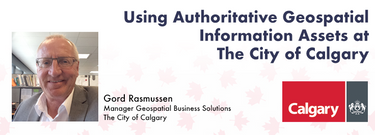
- Using Authoritative Geospatial Information Assets at The City of Calgary Big Four Roadhouse - Theatre 1
- 2:45 PM MST - 3:10 PM MST | 25 minutes
- Creating, managing and sharing geospatial information has never been easier, but how do we ensure the information we are using to make key business...
- Talk

3:30 PM
3:30 PM
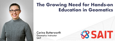
- The Growing Need for Hands-on Education in Geomatics Big Four Roadhouse - Theatre 1
- 3:30 PM MST - 3:55 PM MST | 25 minutes
- Geomatics is growing technically and economically at a rapid pace. The need for skilled, knowledgeable workers is higher than ever. ...
- Talk

4:00 PM
4:00 PM
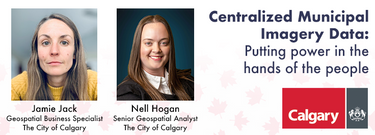
- Centralized Municipal Imagery Data: Putting power in the hands of the people Big Four Roadhouse - Theatre 3
- 4:00 PM MST - 4:25 PM MST | 25 minutes
- Harnessing the power of regular collection of imagery and Lidar, the City of Calgary provides valuable information for municipal service delivery. ...
- Talk


- New AI Powered Tools to Increase Drone Point Cloud Deliverable Productivity Big Four Roadhouse - Theatre 1
- 4:00 PM MST - 4:25 PM MST | 25 minutes
- Learn how newly implemented surface modeling tools employing artificial intelligence reduce the turnaround time of point cloud surface models by...
- Talk


10:00 AM
10:00 AM
- Lidar CANEX Panel Big Four Roadhouse - Theatre 2
- 10:00 AM MST - 10:45 AM MST | 45 minutes
- Join us at the GoGeomatics Expo for a dynamic panel discussion on the latest trends in Lidar technology. Our panel of experts will dive into the ad...
- Panel
-
 LidarCanex 2024Sponsor


11:00 AM
11:00 AM
- SLAM Scan-Off Results Big Four Roadhouse - Theatre 2
- 11:00 AM MST - 12:00 PM MST | 1 hour
- Rapid, short-range data collection will only become more critical as the technological revolution continues. From planning and analytics to VDC ...
- Talk


12:00 PM
12:00 PM
- Canada’s SLAM Market: Applications & Considerations for Industry Big Four Roadhouse - Theatre 2
- 12:00 PM MST - 1:00 PM MST | 1 hour
- The SLAM Scan-off results are in, but what does that mean, where can this technology be applied, and what technology can be applied to it?Jo...
- Panel


1:45 PM
1:45 PM
- Airborne Topo-Bathymetric Lidar Combined with Thermal Imaging for Fish Habitat Studies in Rivers Big Four Roadhouse - Theatre 1
- 1:45 PM MST - 2:10 PM MST | 25 minutes
- Research Presentation:Airborne Topo-Bathymetric Lidar Combined with Thermal Imaging for Fish Habitat Studies in RiversResearchers at ...
- Talk

2:15 PM
2:15 PM
- Integration of BIM / GIS to achieve the digital built environment for the Department of National Defence Big Four Roadhouse - Theatre 1
- 2:15 PM MST - 2:40 PM MST | 25 minutes
- The Department of National Defence, as steward of a real property (RP) portfolio that includes tens of thousands of buildings and supporting infras...
- Talk

