
Darren Flach
GIS Technician
Recent SAIT BGIS grad
Sessions in which Darren Flach attends
7:00 PM
7:00 PM
- Panel - Discussing the Opportunities and Future of Canada’s National Geomatics Expo Big Four Roadhouse - Theatre 1
- 7:00 PM MST - 8:00 PM MST | 1 hour
- Step into the exciting realm of the inaugural GoGeomatics Expo in Calgary, a historic event that is set to make waves in Canada's geospatial sec...
- Panel


9:00 AM
9:00 AM
- GoGeomatics Expo Poster Program
- Tue 7, 09:00 AM MST - Wed 8, 04:00 PM MST | 1 day 7 hours
- Student posters will be available for viewing in the Expo Gall...
-

- Canadian Cartographic Association Student Map Competition 2022/23 Results Big Four Roadhouse - Poster Area
- Tue 7, 09:00 AM MST - Wed 8, 04:00 PM MST | 1 day 7 hours
- The Expo proudly showcases the Canadian Cartographic Association Student Map Competition.Discover the recipients of the Best Stud...
-

9:45 AM
9:45 AM
- Welcome Big Four Roadhouse
- 9:45 AM MST - 10:00 AM MST | 15 minutes
- Talk


10:00 AM
10:00 AM
- Evolving Reality Capture Panel Big Four Roadhouse - Theatre 2
- 10:00 AM MST - 10:45 AM MST | 45 minutes
- Join us for a riveting panel discussion featuring leading experts in the realm of reality capture. As the industry stands on the precipice of mo...
- Panel


10:30 AM
10:30 AM
- Accurate, Efficient and Cost-Effective Subsurface Utility Data – From Field Collection to 3D Modelling Big Four Roadhouse - Theatre 3
- 10:30 AM MST - 10:55 AM MST | 25 minutes
- SUMMARYWith the increasing focus on damage prevention, public safety concerns, and environmental damage due to underground utility strikes, ...
- Talk

12:00 PM
12:00 PM
- LiDAR for Post Wildfire Mapping Applications Big Four Roadhouse - Career Theatre
- 12:00 PM MST - 12:25 PM MST | 25 minutes
- LiDAR continues to be a cornerstone of the mapping industry. Since its inception, the technology has evolved from sole use on manned aircraft to be...
- Talk

12:30 PM
12:30 PM
- Flood Hazard Mapping Data and Its Importance: Jurisdictional Complexity, Innovation in Data Dissemination, and Advancing Adaptation Big Four Roadhouse - Theatre 3
- 12:30 PM MST - 12:55 PM MST | 25 minutes
- Flooding is Canada’s most costly natural disaster, and flood risk intensifies as a result of urbanization and climate change. These impacts will...
- Talk


- Changing Your Frame of Reference: Reference Systems and Positioning in Canada Big Four Roadhouse - Theatre 1
- 12:30 PM MST - 12:55 PM MST | 25 minutes
- Geodetic Reference Systems are the foundation for geospatial data, serving as the official reference for latitude, longitude, height and gravity...
- Talk


Calvin Klatt PhD
Speaker
1:00 PM
1:00 PM
- Lunch Break Big Four Roadhouse
- 1:00 PM MST - 1:45 PM MST | 45 minutes
- Menu - Big Four OutletAppetizers
-
1:30 PM
1:30 PM
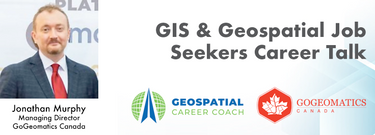
- GIS & Geospatial Job Seekers Career Talk Big Four Roadhouse - Career Theatre
- 1:30 PM MST - 1:50 PM MST | 20 minutes
- This talk focused on those seeking work in GIS, cartography, remote sensing, programming, and other related geospatial...
- Talk
1:45 PM
1:45 PM
- Diversity Leadership Panel Big Four Roadhouse - Theatre 2
- 1:45 PM MST - 2:30 PM MST | 45 minutes
- The GoGeomatics Expo and our sponsors are proud to present the Diversity in Leadership Panel.
- Panel


2:15 PM
2:15 PM
- GIS Solutions Enhancing Emergency Response, Management, and Response Team Assessments Big Four Roadhouse - Theatre 1
- 2:15 PM MST - 2:40 PM MST | 25 minutes
- Incidents involving dangerous goods, including flammable gases and liquids, can happen at any time and in any place. When they do, Emergency Res...
- Talk


2:45 PM
2:45 PM
- buildingSMART BIM/GIS Panel Big Four Roadhouse - Theatre 2
- 2:45 PM MST - 3:30 PM MST | 45 minutes
- Join us at the BIM/GIS panel of our conference as we delve into critical subjects shaping the intersection of Building ...
- Panel


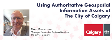
- Using Authoritative Geospatial Information Assets at The City of Calgary Big Four Roadhouse - Theatre 1
- 2:45 PM MST - 3:10 PM MST | 25 minutes
- Creating, managing and sharing geospatial information has never been easier, but how do we ensure the information we are using to make key business...
- Talk

3:30 PM
3:30 PM
- Unlocking the Power of GIS in Facility Management: An Introduction to VertiGIS FM Big Four Roadhouse - Theatre 3
- 3:30 PM MST - 3:55 PM MST | 25 minutes
- As GIS professionals, we understand the pivotal role that geospatial data plays in decision-making across various industries. Now, imagine harnessi...
- Talk


4:00 PM
4:00 PM
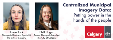
- Centralized Municipal Imagery Data: Putting power in the hands of the people Big Four Roadhouse - Theatre 3
- 4:00 PM MST - 4:25 PM MST | 25 minutes
- Harnessing the power of regular collection of imagery and Lidar, the City of Calgary provides valuable information for municipal service delivery. ...
- Talk


4:30 PM
4:30 PM
- Expo Reception Party Big Four Roadhouse - Expo Trade Show Floor
- 4:30 PM MST - 7:00 PM MST | 2 hours 30 minutes
- The end of the first day of the National Canadian GoGeomatics Expo is being marked by a lively party that is eagerly anticipated by all participant...
-

10:00 AM
10:00 AM
- Empowering Resilient Communities through openBIM: Enhancing Efficiency, Sustainability, and Collaboration for a Smarter Built Environment Big Four Roadhouse - Theatre 3
- 10:00 AM MST - 10:25 AM MST | 25 minutes
- openBIM aims to make the built environment more efficient, sustainable, and productive, leading to more liveable and resilient communities. Smar...
- Talk


10:30 AM
10:30 AM
- Leadership Panel: What is Teamship and Why Does it Matter to Geomatics Leadership? Big Four Roadhouse - Theatre 1
- 10:30 AM MST - 11:15 AM MST | 45 minutes
- Great Leadership is central to our Industry – leaders that are adeptly able to connect and interoperate with business, government, and institutiona...
- Panel


12:00 PM
12:00 PM
- Canada’s SLAM Market: Applications & Considerations for Industry Big Four Roadhouse - Theatre 2
- 12:00 PM MST - 1:00 PM MST | 1 hour
- The SLAM Scan-off results are in, but what does that mean, where can this technology be applied, and what technology can be applied to it?Jo...
- Panel


12:30 PM
12:30 PM
- Establishing an Urban Infrastructure Mapping Research Program Big Four Roadhouse - Theatre 1
- 12:30 PM MST - 12:55 PM MST | 25 minutes
- Geoff Zeiss devoted over 30 years of his life to the Geospatial industry and global community, focusing on utility and construction sectors, and ma...
- Talk


1:00 PM
1:00 PM
- Lunch Break
- 1:00 PM MST - 1:45 PM MST | 45 minutes
- Menu - Big Four OutletAppetizers
-

1:45 PM
1:45 PM
- Fast Pitches Big Four Roadhouse - Theatre 2
- 1:45 PM MST - 2:45 PM MST | 1 hour
- Got a cool geomatics product, service, student project, or academic/science research project/paper? Pitch it to a select panel of geomatics pres...
-

2:15 PM
2:15 PM
- Integration of BIM / GIS to achieve the digital built environment for the Department of National Defence Big Four Roadhouse - Theatre 1
- 2:15 PM MST - 2:40 PM MST | 25 minutes
- The Department of National Defence, as steward of a real property (RP) portfolio that includes tens of thousands of buildings and supporting infras...
- Talk

4:00 PM
4:00 PM
- Closing Big Four Roadhouse
- 4:00 PM MST - 4:15 PM MST | 15 minutes
- Talk
