Kacy Hyndman
Sessions in which Kacy Hyndman attends
Tuesday 13 May, 2025
Mini Continental BreakfastGeoIgnite is delighted to offer a selection of chilled fruit juices, freshly baked croissants, muffins, and breakfast pastries, served with butter and preserves. Guests can also enjoy fruit cocktails and yogurt. Available beverages include coffee, tea, and decaffeinated coffee.
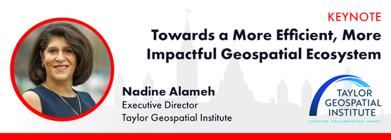
For decades, Canada’s geospatial ecosystem has thrived on deep integration with the U.S., benefiting from shared technology, markets, and collaboration. But today, shifting geopolitical and economic realities—trade conflicts, supply chain vulnerabilities, and data sovereignty concerns—are forcing us to rethink this reliance. The question is no longer whether we should adapt, but how.
Dr. Nadine Alameh, the inaugural Executive Director of the Taylor Geospatial Institute, has been leading an ambitious effort to accelerate geospatial research for tackling today’s biggest challenges—climate, disasters, health, and national security. In this session, she will reflect on what it takes to build a truly impactful geospatial ecosystem, challenge assumptions about the roles of national mapping agencies, academia, and nonprofi...
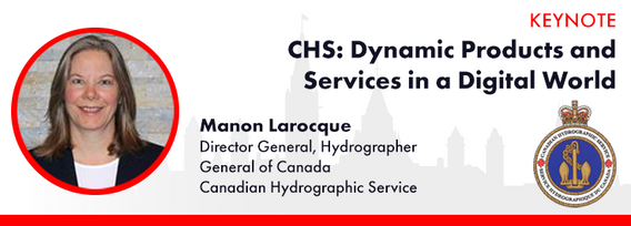
The Canadian Hydrographic Service (CHS) is Canada's agency for charting Canadian waters. Canada has the longest coastline of any country in the world, with more than a third of its territory under water. As a maritime nation, global maritime transport traffic is significant. Hydrography supports safe navigation and shipping through the production of nautical charts and other publications including water levels. With opportunities provided by emerging technologies and the move to e-navig...
In 2006, British mathematician Clive Humby declared that data was the new oil. Soon after there was a significant rush around the world to embrace a data revolution to try and improve humanity’s social, economic and environmental well being. Twenty-years later, the hard work of data continues. Like Canadian oil and gas, it is for the most part – a landlocked asset; unable to push us to the next levels of productivity and innovation. This keynote looks at ...
Top technical performers are often promoted into leadership roles, yet many struggle. In AI-driven, data-intensive industries, expertise alone is not enough—leaders must also navigate complexity, inspire teams, and drive execution. Without these skills, organizations face decision paralysis, disengaged teams, and stalled innovation.Senior leaders know that competency is crucial—technical excellence is the foundation of succes...
Enjoy a satisfying lunch inspired by classic Italian flavors. Begin with artisanal garlic focaccia and a classic Caesar salad with creamy dressing, croutons, and bacon bits. A medley of olives and marinated mushrooms adds a savory touch.For the main course, enjoy chicken scallopini glazed with a lemon caper sauce, served alongside potato gnocchi in a tomato and basil sa...
At GeoIgnite 2025, Alexander will explore how Canada's geospatial community is uniquely positioned to lead in developing solutions to environmental challenges in a rapidly changing geopolitical landscape. Drawing on compelling case studies from around the globe, including successful Dutch-Canadian collaborations, he will demonstrate how geospatial technologies are becoming indispensable tools for environmental monitoring, climate resilience planning, and sustainable...
Wednesday 14 May, 2025
Mini Continental BreakfastGeoIgnite is delighted to offer a selection of chilled fruit juices, freshly baked croissants, muffins, and breakfast pastries, served with butter and preserves. Guests can also enjoy fruit cocktails and yogurt. Available beverages include coffee, tea, and decaffeinated coffee.
As the built asset industry embraces digital transformation, the integration of Building Information Modeling (BIM) and Digital Twin technologies is redefining how we manage the built environment. While BIM facilitates data-rich 3D modeling during design and construction, Digital Twins extend this functionality into operations, enabling real-time insights and lifecycle optimization.Attendees will gain insights into buildingSMART Canada’s initiatives supporting this integration, its ali...
Each season the Earth Observation Team of Agriculture and Agri-Food Canada (AAFC) maps crop types of individual fields across Canada. They developed an operational in-house software system to decipher crop types using satellite observations and trustworthy ground information. Multi-temporal optical & SAR data are collected over the agricultural growing regions of Canada. These images are combined with provincial crop insurance data (the most accurate, detailed and complet...
The presentation focuses on the challenges of applying ISO 19650 to National Defence and Defence Construction Canada, examining the current status and progress, as well as the obstacles still faced. It highlights the key challenges of becoming a knowledgeable owner while aligning National Defence practices with ISO19650, with support from other stakeholders and partners through research, innovation, and collaboration. The importance of OpenBIM in this context is emphasized, as it plays a crit...
Natural Resources Canada’s (NRCan) Emergency Geomatics Service (EGS), under the Canada Centre for Mapping and Earth Observation (CCMEO), supports the national and international emergency response efforts by providing rapid disaster mapping services. This presentation will give an overview of the service and highlight examples of how it uses satellite imagery and advanced remote sensing technologies to assess the impact of natural disasters like floods, geohazards, and wildfires, enhancing sit...
National and international civil emergencies are happening with increasing frequency. Geospatial Intelligence can play a critical role in informing and assisting planners, leaders and first responders in preparing for and conducting for operations during and recovery from emergencies.There is a significant Geo Int capability in the Government of Canada as well as in the provinces and regional/local governments. Unfortunately, this capacity is limited when it comes to the ab...
In a world of constant change and uncertainty, how can we make informed decisions in real-time, grounded in the realities of ambiguity? This presentation tackles these fundamental questions by exploring the evolution of how we understand and interpret our world—from childhood curiosity to professional expertise—and how these insights shape decision-making in complex environments.Using case studies in GEOINT adoption inside and outside traditional national security communities, I will d...
Enjoy a fresh and satisfying lunch featuring a house blend of baby spinach, kale, and mesclun greens with feta cheese, pumpkin, chia, and poppy seeds, dried cranberries, and golden raisins. A tomato and cucumber salad with lime and avocado dressing adds a refreshing touch, alongside a medley of mixed greens with assorted dressings.For the main course, savor freshly roas...
SIKU: THE INDIGENOUS KNOWLEDGE APP supports Indigenous self-determination and environmental stewardship through geospatial tools, products and services that enable individuals, communities and organizations to collect, process, analyze and use data. SIKU is created by The Arctic Eider Society, an Indigenous-led charity, and is designed to be accessible: it is available in multiple Indigenous languages, uses icons and a user-friendly design, and works offline and in low-bandwidth regions. SIKU...
In today’s fast-paced world, having timely information at your fingertips is more important than ever. That’s why Health Canada’s Radiation Protection Bureau reached out to Natural Resources Canada’s Centre for Mapping and Earth Observation (CCMEO) for geomatics expertise. The two departments collaborated to create the Real-Time Environmental Radioactivity Monitoring dataset. This map and geospatial data give Canadians clear information on radioactivity levels and fluctuations from natural so...
The Canadian Ocean Mapping Research and Education Network (COMREN) is a national group of academic, non-profit, and federal researchers in ocean and coastal mapping. Since 2016, COMREN has focused on developing research activities, technology transfer to industry, and educational programs that support ocean mapping as a network of dedicated individuals. The group partners with government agencies and international organizations to increase Canada’s domestic and global ocean and coastal mappin...
Join us as we wrap up another incredible edition of GeoIgnite with a celebration on the tradeshow floor. We’ll come together for a group photo of all our amazing participants, partners, and friends.This final moment is our way of saying thank you to everyone who helped make GeoIgnite a success — from speakers and sponsors to delegates and volunteers. Let’s end on a high note and capture the spirit of Canada’s national geospatial leadership event, together.


