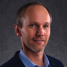
Prashant has worked in the public, private and not-for-profit sectors in a variety of roles and sectors. In the past decade, he provided the vision and worked to establish the Canada Centre for Mapping and Earth Observation and then managed all aspects of its operations as its first Director-General. He also led CCMEO through deep reductions in the early 2010s and then led its renewal and subsequent large scale successes in delivering the highly successful Federal Geospatial Platform (GeoDiscovery); the science and satellite renewal elements of the 2019 Radarsat Constellation Mission; and after two years of consultation and negotiation, the launch of Canada's Flood Hazard Information Mapping Program.
Since 2019, he has been working with a variety of private sector companies where is an investor and he continues to advise Canadian geospatial and space startups. He is the Board Chair of the Open Geospatial Consortium; a Board Member of Building Smart Canada, and Ottawa's Dave Smith Youth Treatment Centre.
Sessions in which Prashant Shukle participates
Tuesday 1 March, 2022
Sessions in which Prashant Shukle attends
Friday 4 March, 2022
The Association of Canada Lands Surveyord (ACLS) has developed a certification model for hydrographers which, has been officially recognized by the IHO/FIG/ICA International Board of Standards and Competence for Hydrographic Surveyors and Nautical Cartographers (IBSC) in April of 2016. The ACLS program is the second internationally recognized scheme in the world. Certification for a hydrographic surveyor is desirable because: - Certification provides a formal...
Thursday 10 March, 2022
Taking urgent action to combat climate change and its impacts" is a crucial goal set forward under Goal 13 – Climate Action as part of the United Nations Sustainable Development Goals (SDGs).Climate action requires global efforts related to climate change mitigation – reducing the flow of heat-trapping greenhouse gases into the atmosphere, or enhancing the "sinks" that accu...
Join this session to get the latest information on Maxar foundational products as well as demonstrations and round-table conversation with our subject matter experts. Please bring your questions if you're a current user, or come ready to experience the industry's best satellite imagery for the first time.


