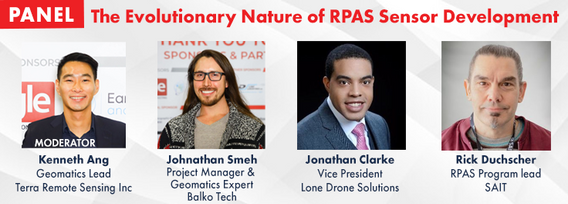
Rick Duchscher
As a Geomatics Engineer, Remotely-Piloted Aircraft Systems (RPAS) Flight Reviewer for Transport Canada as well as a SAIT faculty member with 30 years in the engineering field, I lead SAIT’s Connector lab to support students and industry partners who would like to engage with new and highly advanced technological hardware and software platforms. I help innovate workflows in all areas of construction, information technology, business, energy, manufacturing and transportation to collaboratively and successfully reaching their goal’s outcomes.
My vast experience in 3D modeling, photogrammetry, reality capture, XR, research practices and construction project management has allowed me to advise countless capstone groups and industry partners, assisting learners as they discover their passion for reality capture and geomatics through new theoretical and applied methods.
Other areas of expertise include project management, specialized industrial and commercial RPAS, airborne payload sensors, photography, terrestrial laser scanning applications, GIS, web mapping, technical writing and earthworks.
Sessions in which Rick Duchscher participates
Wednesday 30 October, 2024
RPAS platforms and sensors have come a long way since their commerical adoption almost a decade ago and have quickly become a main stay of many professional's tool kits. This show's the industry's appetite for adopting new technologies and matching them up with the right application. With a pannel of very experienced professionals from various sectors of Canada's Geospatial RPAS scene, we explore what has driven sensor development and how sensors might further develop along the lines of use c...
Sessions in which Rick Duchscher attends
Monday 28 October, 2024
We are excited to announce that the next Canada Forum will be held during the GoGeomatics Expo in Calgary, from October 28th to 30th. This event will bring together key stakeholders from across Canada’s geospatial sector, including industry leaders, academics, indigenous communities, government representatives, and technologists, to continue vital discussions on advancing geospatial standards, interoperability, and spatial data infrastructure (SDI) in Canada.
We are excited to announce that the next Canada Forum will be held during the GoGeomatics Expo in Calgary, from October 28th to 30th. This event will bring together key stakeholders from across Canada’s geospatial sector, including industry leaders, academics, indigenous communities, government representatives, and technologists, to continue vital discussions on advancing geospatial standards, interoperability, and spatial data infrastructure (SDI) in Canada.
Tuesday 29 October, 2024
Stand Out in a Crowded Market In a world overflowing with information, every company needs a compelling marketing strategy to stand out. It’s not enough to simply analyze and map data—you need to tell its story in a way that truly resonates with people. But let’s face it—translating complex geospatial data into engaging content can be a challenge.


