Wednesday 15 May, 2024

Mini Continental BreakfastGeoIgnite is delighted to offer a selection of chilled fruit juices, freshly baked croissants, muffins, and breakfast pastries, served with butter and preserves. Guests can also enjoy fruit cocktails and yogurt. Available beverages include coffee, tea, and decaffeinated coffee.

As evidenced by the 2023 fire season, we are experiencing unprecedented fire management challenges in Canada. Innovative fire monitoring solutions can help support wildfire managers as they limit the negative impacts of wildland fires while also prioritize the positive benefits in Canada’s forested ecosystems. Opportunities for advancing fire monitoring mirror a broader paradigm shift in the field of Earth observations towards open data, large-scale analyses, and collaborative development. In...


GeoIgnite is excited to present a high-profile panel discussion, "Navigating New Frontiers: The Role of Geospatial AI in Shaping Our World." This session brings together three influential leaders in the field: Bilyana Anicic, President of Aurora Consulting, Jon Lipinski, Co-Founder and President of Ecopia Tech; Abe Tarapani, CEO of Atlas AI; and Will Cadell, CEO of Sparkgeo.Bilyana Anicic, President of Aurora Consulting and the architect of the Federal Geosp...


The domains of BIM and GIS have historically been separate areas of expertise and been considered distinct and separate domains. However, the need for geospatial technologies to integrate with Building Information Modeling (BIM) design applications and the need for BIM geometry and data to be applied in Geographic Information Systems (GIS) is becoming more prevalent. In the rapidly evolving period of urban development, BIM and GIS emerge as pivotal technology tools shaping the future of...


Remote sensing and spatial analytics have substantial utility to support riverine and floodplain assessment and monitoring at extents not feasible with traditional field surveys. This presentation will provide an overview of relevant technologies such as topobathymetric lidar, sonar, and multiple imagery types, as well as processes for integrating and analyzing these data. Broad-scale, objective, and reproducible analytics allow for geographic and temporal comparison across entire...


In an increasingly complex and rapidly evolving geospatial landscape, the demand for skilled professionals who can deliver tailored solutions is at an all-time high. Recognizing this need, GoGeomatics Canada, the Sault Ste. Marie Innovation Centre (SSMIC), and OnPar have joined forces to provide comprehensive staff augmentation services that cater to both the private and public sectors.This presentation at GeoIgnite 2024 will detail ...


Climate change is becoming an increasing threat to Species at Risk in Atlantic Canada. Both direct and indirect impacts of climate change are affecting critical habitat, especially in coastal ecosystems. Monitoring species occurrences and their habitat over time and space is essential to effective conservation initiatives and mitigation efforts. The Atlantic Canada Conservation Data Centre (AC CDC) expertise and data represent the single most comprehensive and current source of information ab...


The Carleton University Immersive Media Studio (CIMS) was awarded a New Frontiers in Research Fund (NFRF) Exploration program grant to Imagine Canada’s Digital Twin. One aspect of the project is data governance and business models. In addition, the I Trust AI research SSHRC funded project based out of UBC, is examining the CIMS and city of Ottawa Digital Twins to assess how their creators might include preservation in their design. These research projects revealed that the Architecture, Engin...


The Department of National Defence, as steward of a real property (RP) portfolio that includes tens of thousands of buildings and supporting infrastructure, is seeking to manage its Real Property (RP) assets more effectively by modernizing and improving its digital capability. In this effort, interoperability between BIM and GIS through open data standards is crucial to enable the Integrated Digital Built Environment. BIM allows representation of detailed information regarding building elemen...


Utilities, telecoms and municipalities are faced with increasing pressure to build infrastructure faster to meet the demands of new provincial legislature. The building broadband, transit and new homes faster acts were enacted to support the ever increasing needs of Canadian population growth from immigration. Learning how to securely faciliate the expansion of utility services required to meet the needs of a growing population is something that all utility, telecom and municipal ...


The Applied Geomatics Research Group, a spinoff of COGS at NSCC in 2000 has been conducting applied research using lidar since it’s inception. Originally by contracting lidar providers to conduct surveys in the Maritimes for flood hazard mapping, then in the 2005 operating their our topographic lidar, the Optech ALTM 3100, then moving into the coastal environment with the Leica Chiroptera 4X topo-bathymetric lidar, and most recently moving to the relatively low cost drones for topo-lidar mapp...


Simplify your AI infrastructure and reduce your interoperability headaches with TileDB, the adaptive database for geospatial AI.The need for geospatial insights with AI requires the management and ETL of legacy geospatial data lakes. Learn how TileDB can model all data as n-dimensional arrays as it sees no data as unstructured. TileDB is multi-modal and supports rasters, point clouds and geometries with a single API.We will explain that TileDB is ideal for Generative AI with geo...


GeoIgnite is proud to present a vital panel discussion titled "Bridging Worlds: Integrating BIM and GIS for a Digital Future in Built Asset Management," featuring distinguished panelists Susan Keenliside, Deputy Director at the House of Commons of Canada, and John Hale, Vice-President of buildingSMART Canada and BIM lead at the Department of National Defence. The session will be moderated by Trevor Taylor of the Open Geospatial Consortium (OGC).


The agriculture and agri-food sector is a major contributor to the Canadian economy, accounting for 2.3 millions jobs and 7% of Canada’s gross domestic product with farmland covering 62 million hectares (6.2%) of Canada’s land area. This area is changing over annual and decadal time scales as a result of changes in annual crop production, urban expansion, sustainable land use/management and a changing climate. Monitoring such a vast area to account for how these environments respond to the pr...


Within its highly dynamic environment, Geospatial Leaders need to integrate knowledge, knowhow, and leadership skills to promote and fully enable this domain while communicating their value proposition to decision makers. This talk will introduce a Framework for leadership development to assist Geospatial Leaders to optimize their success as leaders a...


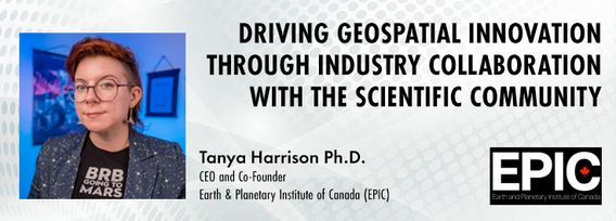
The Earth observation (EO) sector has struggled to break outside its own space echo chamber to have its full potential realised for both social and economic benefit. Can better collaboration between industry and the scientific community help to unlock this potential and drive geospatial innovation? Dr. Tanya Harrison, Co-Founder and CEO of the Earth and Planetary Institute of Canada (EPIC), will highlight examples of such collaborations that have led to breakthroughs that enhanced both indust...


Remotely Piloted Aircraft Systems (RPAS), or drones, are becoming more common in the construction industry as a key tool to complete complex building and infrastructure projects. As technology improves, the barriers to adoption are reduced, creating a huge opportunity for the industry to improve the construction process and support the ongoing digital transformation. Drones boost productivity by enabling construction teams to rapidly and easily survey job sites, track progress, and spot poten...

Day 2 Day Lunch Buffet MenuOn the final day of GeoIgnite, enjoy an exquisite lunch buffet featuring artisanal garlic focaccia and a classic Caesar salad, with croutons and bacon bits served on the side. Relish a medley of olives and marinated mushrooms. Savor lightly breaded chicken breast glazed in a tomato and basil sauce, topped with ...

Climate change presents an array of unprecedented challenges to global resilience and sustainability. As the urgency to address these challenges increases, the role of geomatics as a cornerstone technology for enabling climate resilience becomes ever more significant. This panel discussion, moderated by Tanya Harrison of the Earth & Planetary Institute of Canada, will explore the transformative potential of geomatics in bolstering climate resilience.


Embark on a dynamic exploration of governance fundamentals at the Mastering Governance: Building Strong Foundations session. In the current complex and rapidly evolving business environment, implementing effective governance practices are foundational to guiding organizations toward sustainable growth and resilience.Effective ...


In the rapidly evolving geospatial industry, modern advancements in technology have paved the way for companies to offer geospatial data as a service, revolutionizing the way businesses approach and use geographic information. The advent of micro services to ultimately drive managed services has significantly reduced the necessity for dedicated in-house geospatial teams, providing a cost-effective and efficien...

buildingSMART and the Open Geospatial Consortium have recently published the results of their collaborative effort aimed at developing a joint roadmap toward seamless information continuity between BIM and GIS domains. This session will provide insights regarding this collaborative effort and the joint roadmap between both organizations, which aims to enhance alignment between the two industry bodies on this critical subject. Discover how this roadmap has been crafted to capitalize on global ...


The City of Ottawa (City) annually invests about $3M in studies of the local subsurface geotechnical, hydrogeological, and environmental conditions in support of municipal planning, development proposals, infrastructure designs, construction, and environmental protection studies. Much of this valuable information remains with individual consulting firms and in City project files, so this data is relatively inaccessible and not ready for use to internal and external stakeholders.


The presentation will be focused on the deployment of technological processes on the Centre Block Rehabilitation project and illustrate how the team is managing and manipulating different forms of asset element data for distribution and coordination among an exceptionally large subset of stakeholders, each with their own complex set of requirements and governance policies. Several technologies have been developed and employed to consolidate data from multiple sources so that current and futur...


Global urban expansion is rapidly increasing, with over 50% currently living in cities and an expected rise to 66% by 2050. This growth poses challenges for peri-urban areas, including agricultural land loss, biodiversity destruction, and climate change impacts. Comprehensive research, integrating urban and rural perspectives, is vital, emphasizing the need for quantitative methods like the model analysis approach. The complexity of urban systems, inspired by ecological theories, requires geo...

Canada is big, really big! Mapping the whole country took us over 100 years to complete. Through the years, the techniques used to map Canada's features evolved.For NRCan, the latest innovation is in the operational implementation of Artificial Intelligence tools and approaches, nested in high performance cloud computing capacity, and build via micros-ervices for agile and scalable deployment. This capacity, enables the organization to increase exponentially its capacity to create and ...
