Carina Butterworth P.Eng., PhD(c)
Carina Butterworth has been an instructor at SAIT for 16 years, teaching in Geomatics Engineering Technology, GIS, and Environmental Technologies. Her technical expertise is in remote sensing, microwave imaging, and lidar, and her education expertise follows a radical constructivism philosophy. She has been the faculty advisor on the Geomatics Student Club for 16 years, a faculty representative on the SAIT Academic Faculty Association, a representative on the SAIT Academic Council, and served on many committees over the years at SAIT. She has also volunteered with the Advisory Committee for the GoGeomatics Expo for the past two years and is a cofounder of the CanSLAM Circuit (formally known as the SLAM ScanOff). She is currently working on a PhD in Biomedical Engineering where she is using laser scanning and microwave imaging for breast cancer treatment monitoring.
Sessions in which Carina Butterworth P.Eng., PhD(c) participates
Wednesday 30 October, 2024
The time has come for the presentation of this year's mobile mapping system and SLAM system participants.Are you looking to collect more data, faster and accurately? Looking to buy a mobile mobile mapping or SLAM system and incorporate it into your workflows? If you are, you're considering tens of thousands to millions of dollars of investment. Do you know what's available to you? Are you sure that's all of them? Do the options available suit your needs? Is there candid data you can lo...
Traditional teaching methods in post-secondary often included using powerpoint presentations and writing on a white or blackboard. The newer generations of students have been exposed to different ways of learning and this requires instructors or teaching professors to change their way of presenting information to help the students learn it at a deeper level. Using a radical constructivism philosophy, the students are required to engage in the material in their own way, connect wit...
Sessions in which Carina Butterworth P.Eng., PhD(c) attends
Monday 28 October, 2024
Join us at the National Geomatics Networking Reception Enjoy a selection of gourmet hors d'oeuvres, including savoury Moroccan lamb meatballs, smoked pork belly lollipops, and wild mushroom arancini with truffle oil. Vegetarian options like vegetable samosas with mango chutney and goat cheese tartelettes will satisfy all palates. Plus, your ticket includes a drink to enjoy while you connect with industry professionals. Elevate your evening with these delicious bites and great company!<...
We’re excited to host a special White Hat Ceremony during the Eagle Engineering & Consulting Networking Reception on October 28th at 5:30 PM. This iconic Calgary tradition celebrates the spirit of Western hospitality, welcoming our guests in a unique and memorable way. Be sure to join us as we honor our esteemed supporters from around the world with this special ceremony at the National Geomatics Expo!
Tuesday 29 October, 2024
Space, the final frontier. Or is it? Although many people are fascinated by space, most are relatively unaware of how space technologies pervade their everyday life. From global positioning systems (GPS) and satellite communications to weather forecasting and monitoring the health of crops or the extent of sea ice, the standard of living we currently enjoy is fundamentally dependent on satellites and space technology. Space is becoming even more important in monitoring the changing climate, p...
Session Human footprint datasets for Canada: mapping and monitoring in support of land and resource managementHuman activities have disturbed biodiversity, ecosystems, and ecological processes over the last century. Given the growing trends of habitat loss and biodiversity decline, understanding patterns of human pressures has become a crucial element of conservation planning. In this context, cumulative pressure mapping is used to quantify the extent and intensity of multiple pressure...
For the last five years I have been providing reality capture services to documentary film producers. These series have included NatGeo's Buried Secrets of WWII, NatGeo's Drain the Oceans, Discovery's Expedition Unknown and Expedition Bigfoot. LiDAR, photogrammetry, thermography, magnetometry, and multi spectral imagine all provide context that professional storytellers (TV producers) crave. Join me as I share stories, successes, and failures of these unique service offerings.
Wednesday 30 October, 2024
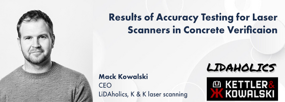
This presentation details the results of a field study conducted in July in Santa Cruz, California, where thirteen participants employed terrestrial laser scanning (TLS) to assess concrete tolerance on a construction site. The study aimed to establish the precision of TLS as a test method for verifying concrete tolerance in accordance with ASTM E-691-23. Additionally, it sought to quantify the bias of the TLS method by compar...
In this year's reality capture track, we have shown you the unprecedented value of reality capture systems when adopted into high-cost, high liability and fast pace environments, some of the problems these systems are solving today, and tools to help the effectiveness and quality of those solutions. However, our presenters will also have demonstrated how critical digital lifecycle planning can be to any asset, from pre-design through construction and lifetime operation right up to demolition,...


