Vanessa Pocock
Sessions in which Vanessa Pocock attends
Tuesday 1 March, 2022
In Budget 2021, the government tabled a recovery plan for jobs, growth, and resilience. Within the budget were specific investments to promoting a healthy environment for a healthy economy, with $145.5 million dedicated to supporting initiatives that will increase resiliency to the natural hazards of wildfires and floods, which are becoming more frequent, severe, and devastating due to climate change and urban development. Flood hazard maps are essential to un...
Abstract: Organizations are increasingly relying on geospatial analysis to power their decision making and business processes. But in such a dynamically changing world, maintaining an accurate database of critical locations is no small task. Everyday worldwide, businesses open and close, change names, or update their operating hours. When these changes happen, any map, application, or model immediately becomes stale. How can organizations strategize if they are not...
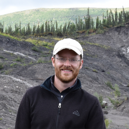
The landscapes in the Northwest Territories (NWT, Canada) are amongst the most rapidly changing in the world due to climate-induced permafrost thaw. This presentation provides an overview of recent remote sensing and mapping investigations of permafrost thaw landslides across different spatial and temporal scales in the NWT. A common thread of ever-expanding geospatial capabilities (remote sensing, machine learning) is juxtaposed against rapidly intensifying permafrost thaw with many growi...
Wednesday 2 March, 2022
Our planet is in flux: pandemics, climate change, inequality. This talk will explore the ideas of "planetary-scale" as it pertains to the geospatial community’s work. We will be looking at how we need planetary-scale thinking to address the planetary-scale problems we are now being challenged with. We don’t have a “Planet B", so how can geospatial technology be used to ethically approach some of the most pressing issues our species have collectively faced? &...
Statistics Canada along with their partner, VertiGIS Studio (formerly Geocortex), have collaborated to update the original Census Program Data Viewer (CPDV) https://www12.statcan.gc.ca/census-recensement/2021/dp-pd/dv-vd/cpdv-vdpr/index-eng.cfm. VertiGIS Studio Web and Reporting were used to configure an advanced web-based data visualization tool, that supports the dissemination of statistical data gathered in the 2021 Canadian census. This tool will make statistical information more...
Join our DG Panel discussion moderated by Jonathan Murphy, Managing Director of GoGeomatics Canada. Our panelists are Eric Laliberté, Éric Loubier and David Harper.As a country spanning almost 10 million square kilometres, Canada has always faced a unique challenge in collecting the day-to-day information needed to provide critical services to Canadians. Today, space offers a unique perspective that is increasingly important to under...
Thursday 3 March, 2022
Sanjay Kumar is the founder and CEO of Geospatial Media & Communications. He also lends his time and experience to many organizations helping them to further the cause of increasing the impact of geospatial technology and its applications at a global scale.
The increase in the availability of high-resolution lidar and other point cloud datasets has given rise to the use of this data for detecting change in the environment over time. Continual improvements in airborne technology and the miniaturization of the requisite sensors has cultivated a nimble new branch of the industry that provides cost-effective data collection services virtually on demand. This ability to employ temporal analysis of the geospatial landsca...
Monday 7 March, 2022
The world is dynamically changing and so are businesses. By some estimates, 20% of new businesses close within one year of opening. In 2020,
Tuesday 8 March, 2022
This workshop will use open tools and standards to create STAC compliant data for a Canadian Federal Dataset. The workshop will focus on the nuances of working on Canadian Data in a Cloud environment. It will further demonstrate modern geospatial data science tools to create a SpatioTemporal Asset Catalogue. Sparkgeo will also demonstrate use in leading desktop and cloud mapping software.
