Gafer Edrise
A seasoned and innovative geospatial expert with 15 years of experience spanning 4 countries. My ability to produce excellent spatial data results by utilizing a wide range of geospatial information from multiple sources coupled with strategic planning, coding and administrative skills makes me stand out from the crowd.
I utlize several sources including remote sensing data (satellite imagery, Lidar, mobile mapping system MMS), photogrammetry data from aerial photo (Airborne and UAV/Drones), surveying data and existing maps, as well as hydrological and statistical data.
Throughout my years of experience, I have conceptualized and lead large scale, national-level projects with multiple teams in the areas of energy and oil, roads, agriculture and town planning, drawing on and adding to my collective leadership, trouble-shooting and project management skills, alongside the ability to work with different cultures and under a wide range of circumstances.
Sessions in which Gafer Edrise attends
- Introduction to SAR/EO Products Workshop, Hosted by MDA
- Signup required
- 1:00 PM EDT - 3:00 PM EDT | 2 hours
- Google Chrome is the preferred browser for this session.
- Workshop


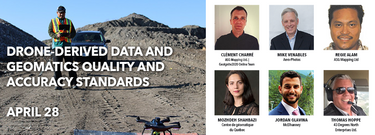
- Drone-derived data and geomatics quality and accuracy standards
- Signup required
- 1:00 PM EDT - 4:00 PM EDT | 3 hours
- Tickets for this workshop must be claimed in advance.The use of drones, officially referred to as Remotely Pilote...
- Workshop