
Vivienne Wu
Vivienne Wu has been with MDA for more than 24 years in the business development role, with knowledge and credential in optical and SAR sensors (ground segment, data, derived information and services). She has extensive experience supporting MDA’s clients and partners in Canada, Latin America and Asia Pacific.
Sessions in which Vivienne Wu attends
Wednesday 21 April, 2021

Join us for the the launch of GeoIgnite with Jonathan Murphy, the Chair of GeoIgnite, and Dr. Minda Suchan of MDA.Abstract of MDA Keynote: Canada is the world leader in wide area space-based radar Earth observation through the highly successful RADARSAT program, supporting numerous operational and scientific uses for Synthetic Aperture Radar (SAR) data. MDA, in conjunction with the Canadian government, has created an internationally recognized brand and reputation for...


Do you know what the geospatial product trap is? We fall in love with the technology, not the problem. I am a lucky person. My job has evolved to one where I primarily get to talk about geospatial technology all day. I could be scoping out internal or external projects or evaluating technologies. Increasingly, I provide advice on product ideas. This final situation has forced me to consider the nature of our community-of-practice. The common assumption that geospatial ...

The Canadian Centre for Mapping and Earth Observation (NRCan) continues its work to implement the National Elevation Data Strategy. Through this strategy, one of NRCan's goal is to provide Canadians with an accurate three-dimensional representation of the country, in support of government priorities such as flood mapping. Because of the enormous task of obtaining a high-precision and up-to-date national elevation layer, NRCan works with different entities.The data coverage of the st...

Over the past year, Minerva Intelligence, a Vancouver-based cognitive AI company, has been awarded two contracts with Natural Resources Canada to design schemas at a national level: the National Flood Hazard Data Layer (NFHDL) and the National Hydro Network V2 (NHNv2). You might be asking yourself why an AI company is designing and building these important database structures. Minerva's cognitive AI system makes use of semantically inoperable data in knowledge graphs and has designed syste...

À l'automne 2020, NV5 Geospatial, propulsé par Quantum Spatial, a été mandaté par la Communauté Métropolitaine de Montréal (CMM) pour réaliser l'un des plus grands levés lidar topobathymétriques aériens fluviaux jamais entrepris au Canada. Cette présentation examinera de plus près le contexte, les objectifs, les défis, la technologie, la méthodologie, ainsi que les résultats et conclusions préliminaires de cette importante étude aérienne des vingt-huit principaux cours d'eau entourant la v...

Explore the structure of an enterprise location intelligence platform at Agriculture Agri-food Canada and how they created a strategic road map to systematically diagnose strengths and weaknesses to drive the use of location intelligence in everyday program and policy decisions of a federal department.Agriculture and Agri-Food Canada supports the Canadian agriculture and agri-food sector through initiatives that promote innovation and competitiveness.

Maxar is building the highest resolution and most accurate 3D map of the planet and this talk will provide an overview of the products and capabilities that are making it possible.

Title: Advancing Space Based Observation in Canada:The GeoIgnite 2021 Directors General Geospatial Panel, part of Canada's National Geospatial Conference.Title: Advancing Space Based Observation in CanadaThis is a must attend panel for anyone interested in learning the direction Canada's Federal government geospatial leadership is taking.Join our panelists for an exploration of Canada's geospatial priorities and mission in this exciting discuss...


Thursday 22 April, 2021

Abstract forth coming: Oversight for CSA program sectors, including in Space Utilization, Space Exploration, and Space Science and Technology.


At a time of rising climate change impacts, there is a vital and growing need to prepare for, respond to, and recover from natural disasters. But there is a critical communication gap between authorities and citizens. Drawing on the results of our massive multi-year climate change R&D project, and with assistance from hundreds of students, citizens, academics, NGOs, and government officials, we have identified the top perceived climate change-relatedcommunication problem...

In this presentation, Dr. Walter Scott will compare the satellite imaging constellations of Maxar and other commercial companies to show how they stack up in three key metrics: product-market fit, adaptability and capital efficiency. He will also share some key insights on the next generation of Earth Intelligence arriving in 2021 with the launch of WorldView Legion, and what impact that will have for the Canadian geospatial market in the months and years ahead.

For nearly 50 years, geomatics representatives from Canadian provinces and territories have collaborated together and with the federal government on geomatics initiatives. This presentation will explore why such a council came to be and why its work matters to the Canadian geomatics sector and citizens alike. While the geomatics sector and the world we live in continue to change, the need for coordination across jurisdictions remains crucial to support decision-making and response to share...

With PetaBytes of data flowing out of Low Earth Orbit everyday, the opportunity afforded by Earth Observation seems to be greater than ever. But is our community realizing that opportunity yet? Are there winners? How should we be thinking about EO businesses in the roaring 2020s?


Friday 23 April, 2021

The global geospatial industry is estimated at US$ 500 Billion and delivers an even more significant impact on society, with derived economic benefits estimated to be multifold. These benefits, however, are still not fully understood by key stakeholders and policy and decision-makers, ultimately hindering the global uptake of geospatial information. With decades of national spatial data infrastructure efforts around the world, how can this be? Focusing on the importance of...


With rapid advances in Earth observation, cloud computing, and analytics technologies, more information on our changing world is more readily available than ever before. Planet is an aerospace and data analytics company at the forefront of these advances -- working to make global change visible, accessible, and actionable, Planet images the full Earth daily at 3.5m resolution and anywhere sub-daily at <50cm. In this talk, we’ll hear from Tara O’Shea, Planet’s Director of Forest Programs, o...

This talk will be bringing together the power of location intelligence and blockchain technology for an increased speed and accuracy of transactions and improved decision-making.The value that blockchain brings to geospatial technology is security, immutability, and trusted data. On the other hand, geospatial technology provides the power of location to the blockchain. Together, they represent a game-changer both for their utility and disrupt...

Join GeoIgnite for this inaugural panel of provincial and territorial geospatial and location technology leaders.We will be discussing issues surrounding: What are main priorities and challenges across jurisdictions? What types of geospatial tools we use to monitor and respond to key challenges like emergency response? How are jurisdictions aligning geospatial tools, data, and people to address climate change? What are some current data...


Monday 26 April, 2021

Tickets for this workshop must be claimed in advance.Join Maxar Product Manager, Jake Dickinson, to learn first-hand how SecureWatch provides commercial and government organizations access to authoritative geospatial information to make decisions and act with confidence. Satellite imagery is foundational to geospatial workflows because it enables analysts to understand and model the locations and characteristics of land, facilities and equipment. But histori...


Tuesday 27 April, 2021

Google Chrome is the preferred browser for this session.Tickets for this workshop must be claimed in advance.Have you ever wanted to learn more about Synthetic Aperture RADAR (SAR) and Electo-Optical (EO) products? Come join this session for an introduction to some of the basic imaging parameters and learn about the different p...

Google Chrome is the preferred browser for this session.Tickets for this workshop must be claimed in advance.This workshop will be broken down into 4 parts:1. Introduction to ERDAS IMAGINE2. Spatial Modeling for Wildlife Applications3. Using AI, Spatial Modeling and Python to Break Down Big Data Barriers4. Q & ASpatial Modeling ...

Wednesday 28 April, 2021

Tickets for this workshop must be claimed in advance.At a time of rising climate change impacts, there is a vital and growing need to prepare for, respond to, and recover from natural disasters. But there is a critical communication gap between authorities and citizens.Drawing on the ongoing results of our massive multi-year climate change R&D project, and with assistance from hundreds of students, citizens...

Thursday 29 April, 2021
Tickets for this workshop must be claimed in advance.From Imagery Purchasing to Final ProductImagery Intelligence Analysis WorkflowGeospatial intelligence is the first step in any battle or business plan. Understanding the terrain and the subject in question is the key to success or failure.In this 90 min workshop we will discuss the process from how to purchase satellite imagery to producing ...
Friday 30 April, 2021
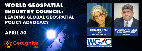
World Geospatial Industry Council: Leading global geospatial policy AdvocacyApril 30 2021, 13:00 - 14:30 EDTVirtual Workshop at GeoIgnite 2021: Canada's National Geospatial Conferencehttps://sites.grenadine.co/sites/goge...
