
Rachael Louise
Sessions in which Rachael Louise attends
Thursday 22 April, 2021

With PetaBytes of data flowing out of Low Earth Orbit everyday, the opportunity afforded by Earth Observation seems to be greater than ever. But is our community realizing that opportunity yet? Are there winners? How should we be thinking about EO businesses in the roaring 2020s?


Friday 23 April, 2021

In this presentation by Avenza Systems, we will be showcasing how high quality cartographic outputs after your data analysis can actually be achieved! We will demonstrate how to develop and design a map from raw statistical census data in Adobe Illustrator by leveraging the geospatial functionalities of MAPublisher - the industry-standard cartography solution for high quality graphical output. We’ll show how GIS data can be imported, managed, and transformed on-the-fly all d...

In 2003, when GISPartner entered the business Poland was still far behind more developed countries in terms of IT implementation. In 2021 the gap is incomparably smaller and some of Polish IT solutions are widely used across the globe. When public administration is considered, it was also GISPartner, which greatly contributed into transforming paper & stamps into high-class software solutions. We want to share our thoughts on how clever, tailor-made IT solutions are driving this transf...

With rapid advances in Earth observation, cloud computing, and analytics technologies, more information on our changing world is more readily available than ever before. Planet is an aerospace and data analytics company at the forefront of these advances -- working to make global change visible, accessible, and actionable, Planet images the full Earth daily at 3.5m resolution and anywhere sub-daily at <50cm. In this talk, we’ll hear from Tara O’Shea, Planet’s Director of Forest Programs, o...

The Government of Canada and organizations such as the UN recognize the critical role of standards in geographic information and geomatics to support stewardship and interoperability of information, ensuring that organizations access, use and share geospatial data efficiently and effectively to support program and service delivery to Citizens. The data inventory/catalogue and the supporting standards are foundational components of any national geospatial information framework. As such, wel...
Monday 26 April, 2021

PLEASE NOTE THE PREFERRED BROWSER IS GOOGLE CHROME. If you are running into any issues accessing the session, please try logging in via Google Chrome.The use of drones or UAVs has expanded dramatically over the last few years and this technology is rapidly permeating a wide variety of professional disciplines and industries, including the broad field of GIS. Ideally suited for on-demand geospatial data collection, drones can effectively eliminate the logjam tha...

Tuesday 27 April, 2021

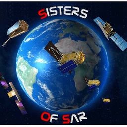
Google Chrome is the preferred browser for this session.Tickets for this workshop must be claimed in advance.Have you ever wanted to learn more about Synthetic Aperture RADAR (SAR) and Electo-Optical (EO) products? Come join this session for an introduction to some of the basic imaging parameters and learn about the different p...

Google Chrome is the preferred browser for this session.Tickets for this workshop must be claimed in advance.This workshop will be broken down into 4 parts:1. Introduction to ERDAS IMAGINE2. Spatial Modeling for Wildlife Applications3. Using AI, Spatial Modeling and Python to Break Down Big Data Barriers4. Q & ASpatial Modeling ...

Wednesday 28 April, 2021

Tickets for this workshop must be claimed in advance.At a time of rising climate change impacts, there is a vital and growing need to prepare for, respond to, and recover from natural disasters. But there is a critical communication gap between authorities and citizens.Drawing on the ongoing results of our massive multi-year climate change R&D project, and with assistance from hundreds of students, citizens...


Tickets for this seminar must be claimed in advance.GeoIgnite , and Peggy March, Paul VanZant, Dr. Lynn Moorman, Dr. Gordon Osinski, Dave MacLean, Dr. Trevor Bell, Jonathan Murphy, and Ewan Geddes, all Fellows of the Royal Canadian Geographical Society www.rcgs.org, in conjunction with Canadian Geographic Education www.cgeducation.ca , invite you to this event. The purpose is to showcase and raise awareness ...


Dr. Gordon “Oz” Osinski is a Professor and the NSERC/MDA/CSA/CEMI Industrial Research Chair in Earth and Space Exploration in the Department of Earth Sciences at the University of Western Ontario (Western), Canada. He holds a PhD from the University of New Brunswick (2004) and a BSc (Hons) from the University of St. Andrews (1999), Scotland, both in Geology. Dr. Osinski’s research interests are diverse and interdisciplinary in nature. His main area of research focuses on understanding impact ...


Sometimes your vision of what your career path will be and what it actually ends up being can be quite different from one another. Dr. Tanya Harrison will discuss her somewhat non-traditional and non-linear pathway through academia and into the space industry, focusing on topics such as transferable skill sets and not being afraid to take a detour—or a different path entirely—if an opportunity or speed bump arise.

As examples of various online map styles and techniques, Dave prepares maps of pictures of Earth taken by astronauts and cosmonauts onboard the International Space Station. These are also "of interest" to many in the general public. In this talk, he'll dive into some favourites photos, some of the mapping techniques, and some interesting anecdotes along the way. View the whole set of maps at https://isspix.com/MapTourHowTo

Geography plays an important role in being a parent and a teacher. Developing geographical perspectives gives a sense of understanding cultural connections and the complexity of building relationships. The connections of understanding the purpose of our actions towards physical and human sustainability. It is a lens of perspective understanding that defines human actions and connections.


Thursday 29 April, 2021
During the past 30 years the Damage prevention and Utility Engineering industry has grown and developed into what it is today. The industry has slowly grown year after year and has gained acceptance as a best practice with 811 laws in the US and in Ontario the Call Before you dig legislation Bill 8 a precedent setting event in Canada. We now look at how best to modernize the systems and leverage technology to elevate the 2 industries damage prevention and Utility Engineering. The te...

The Canadian Cartographic Association (CCA), is a National non-profit organization that helps advance geographic education in Canada through the use of mapping technology. We host annual cartography related conference and events, and promote geography awareness through scholarship and awards. CAA membership is open to anyone with an interest in any aspect of mapping. If you have a passion for maps then we encourage you to check out our website https://cca-acc....

Tickets for this workshop must be claimed in advance.This workshop will offer a deep-dive into the Avenza Maps app, a mobile app where users can upload or access custom maps for off-line navigation, way-finding, and data collection. The workshop will be composed of 5 modules covering the fundamentals of the apps usage, as well as more advanced industry-relevant features. We will also provide a walkthrough of using the Av...


Friday 30 April, 2021

Tickets for this workshop must be claimed in advance.This half-day workshop cuts through the theory and fluff to present, in practical terms, the essential practices for successful GIS project planning and management. Its intent is to provide project managers, teams, and stakeholders with the key actions methods, and tools to launch and execute successful projects --delivering results on time and on budget providing valuable...
