Wednesday 30 October, 2024
We will explore tangible ways in which to involve Indigenous people, especially youth, in a new ad, emerging infrastructure business sector.Dale Booth will lead you through a more fulsome understanding of Indigenous inclusion and participation on major infrastructure projects and how working with Indigenous companies, especially in the BIM modelling space, can greatly improve opportunities for everyone.Innovation 7 has been successful in the identification of training and work p...
This presentation details the results of a field study conducted in July in Santa Cruz, California, where thirteen participants employed terrestrial laser scanning (TLS) to assess concrete tolerance on a construction site. The study aimed to establish the precision of TLS as a test method for verifying concrete tolerance in accordance with ASTM E-691-23. Additionally, it sought to quantify the bias of the TLS method by compar...
Case Study: How DOTs and Utility owners took a Proactive Approach to Protect Underground Pipeline Assets Due to aging infrastructure and lack of accurate utility location information resulting in huge increased operational risk & especially at waterway, transportation, and ROW utility crossings. Utility owners understand the significant underground congestion and utility conflicts which result in future damages and the value the importance of geo location of UNLOCA...
RPAS platforms and sensors have come a long way since their commerical adoption almost a decade ago and have quickly become a main stay of many professional's tool kits. This show's the industry's appetite for adopting new technologies and matching them up with the right application. With a pannel of very experienced professionals from various sectors of Canada's Geospatial RPAS scene, we explore what has driven sensor development and how sensors might further develop along the lines of use c...
This presentation provides a comprehensive exploration of the latest advancements in construction technology. From traditional methods to cutting-edge innovations, we'll examine how technology is reshaping the construction industry.Key topics will include:Historical Context: A brief overview of the evolution of construction techniques and the impact of technological advancements.Modern Construction Methods: Exploring traditional methods and how they've been enhance...
The Virtual Assembly Showcase highlights the value of integrating advanced 3D laser scanning and virtual assembly in industrial construction. In a recent expansion at a major Oil Sands Refinery, detailed 3D laser scanning and surveying were employed to ensure the precise placement and assembly of three large modules while they were still in the laydown yard.The process involved scanning critical structural elements and newly poured foundation pilings to detect potential fitment issues ...
Local governments have been updating their asset inventories to comply with the TCA legislation since the early 2000s, paying particular attention to the attributes, locations, ages and conditions of their assets. However, infrastructure changes constantly due to capital projects and land development, especially in fast-growing municipalities like Kelowna. Collecting accurate and complete information on new assets has been a major challenge, mainly due to limited staff resources. To address t...
Join us for an engaging panel discussion on Geo-Entrepreneurship, featuring distinguished experts from geospatial consultancies, geomatics communication and event companies, and geomatics software firms. This session is designed for those interested in the intersection of geospatial technology and entrepreneurship.Journey to Entrepreneurship: Hear from our panelists on their motivations for leaving traditional careers to pursue entrepreneurial ventures in the geospatial field. Dis...
Photogrammetry is not just limited to aerial platforms. Modern mobile devices contain high-quality cameras and increasingly have LiDAR and depth sensors built in. When combined with high-accuracy GNSS systems, these mobile devices can quickly collect accurate data for utilities, infrastructure, inspection, as-builts, construction, and more. Utilizing these readily available devices can reduce project delays, capture better documentation of utilities, and lay the foundations for digital infras...
Menu - Big Four OutletAppetizersRoasted Diablo Pork Bites (12) (GF/DF) SaladsSpiced Cauliflower, Chickpea & Tofu Bowl (GF/DF/V/VE) Sweet Potato, Roasted Cauliflower, Chickpeas, Mint Chutney,Grilled Tofu, Madras Curry DressingClassi...
This presentation delves into two key initiatives underway by buildingSMART Canada: The Digital Transformation for Bridges and a Digital Construction Platform at the National Research Council of Canada. A "Digital Transformation for Bridges Workshop," organized by buildingSMART Canada to unify bridge asset owners across federal, provincial, and municipal levels. The need to overcome the challenges in integrating dive...
Dillon was retained by the Government of Nunavut to perform a Needs Assessment for the rehabilitation of the Runway 13-31, Taxiway A (Alpha), Taxiway C (Charlie), Apron A, and Apron C of the Rankin Inlet Airport.The project included pavement rehabilitation and geotechnical investigations for Runway 13-31, which is a 6000’ x 150’ asphalt paved runway, along with Phase I ...
Utility mapping is a crucial practice in urban planning and construction, focusing on identifying, documenting, and visualizing the precise locations of underground utilities such as water pipes, gas lines, electrical conduits, and telecommunication cables. Accurate mapping of these utilities is vital to ensure safety, efficiency, and cost-effectiveness in construction projects, preventing accidental damages that can lead to significant service disruptions, safety hazards, and financial losse...
In this year's reality capture track, we have shown you the unprecedented value of reality capture systems when adopted into high-cost, high liability and fast pace environments, some of the problems these systems are solving today, and tools to help the effectiveness and quality of those solutions. However, our presenters will also have demonstrated how critical digital lifecycle planning can be to any asset, from pre-design through construction and lifetime operation right up to demolition,...
With drones like the DJI Matrice 300 now being positioned using RTK GNSS, combined with Structure from Motion (SfM), high precision mosaics are possible without deploying targets. The ability to mount lidars (DJI L1 and L2) and other optical sensors (RGB, multispectral, thermal) allows for precise surveying and the production of high resolution and high accuracy mosaics with minimal ground control. While battery power still remains an issue and the limiting factor for flight duration (10’s of...
The presentation is geared towards providing an engaging discussion on what are the opportunities organizations adopting BIM would benefit, such as:Enhanced collaboration: BIM facilitates collaboration among all disciplines, stakeholders, and contractors, reducing errors and miscommunication using real-time data when applications to ensure all parties have access to the most current project information.Risk Management: Early detection of issues and clashes during design c...
The time has come for the presentation of this year's mobile mapping system and SLAM system participants.Are you looking to collect more data, faster and accurately? Looking to buy a mobile mobile mapping or SLAM system and incorporate it into your workflows? If you are, you're considering tens of thousands to millions of dollars of investment. Do you know what's available to you? Are you sure that's all of them? Do the options available suit your needs? Is there candid data you can lo...
As the drone industry is increasingly focuses on developing larger airframes and equipping them with bigger sensors, Spexi is taking a revolutionary approach to aerial imagery. At Spexi, we believe that the future of geospatial data collection lies not in size and complexity, but in numbers and standardization. The Spexi platform leverages the power of crowdsourcing, deploying local pilots with small drones to capture standardized imagery across entire cities. This method allows us to achieve...
This panel will explore how to effectively identify the standard and quality level under which Subsurface Utility Engineering (SUE) data was collected, following established guidelines such as the ASCE 38-22 Standard. A key focus will be on how this data can be repurposed for future projects while ensuring that liability does not fall back on the original professional who signed off on the data. Panelists will also discuss t...
Menu - Big Four OutletAppetizersRoasted Diablo Pork Bites (12) (GF/DF) SaladsSpiced Cauliflower, Chickpea & Tofu Bowl (GF/DF/V/VE) Sweet Potato, Roasted Cauliflower, Chickpeas, Mint Chutney,Grilled Tofu, Madras Curry DressingClassi...
Led by the World Geospatial Industry Council (WGIC) and moderated by Aaron Addison, Executive Director of WGIC, this panel will explore the transformative role of Earth observation (EO) technologies in fostering a resilient and sustainable future for Canada. With growing environmental challenges such as climate change and resource management, EO solutions provide essential insights into monitoring ecosystems, disaster resilience, and sustainable development. Panelists from diverse sectors wil...
As BIM, GIS, & Reality capture technologies begin to converge, the need for interoperability becomes ever more important and being accessible to all stakeholders. From design to construction, through handover and ownership, many different technologies are employed to create, capture, and maintain data sets. As more and more of this data is created in many different platforms and formats, the opportunity for missed information or breakdown in communication grows immensely. In this presenta...
Traditional teaching methods in post-secondary often included using powerpoint presentations and writing on a white or blackboard. The newer generations of students have been exposed to different ways of learning and this requires instructors or teaching professors to change their way of presenting information to help the students learn it at a deeper level. Using a radical constructivism philosophy, the students are required to engage in the material in their own way, connect wit...
In countries that have very accurate and accessible map records, utility damage events are a rare occurrence. Japan with a one third of the population of the US has less than 200 line strikes per year. We will discuss how creating, sharing, and using accurate maps is critical in reducing damage to buried infrastructure.
Project Overview: Discuss the integration process of the Connectiv LiDAR system with the Velos Rotors V3 UAV, focusing on custom modifications for transportation infrastructure inspections and topographic mapping. Highlight the key features and benefits of the custom UAV solution, such as modularity, precision, and safety.Innovative Payloads: Highlight the use of Phase One P3, Drone Rescue Systems DRS-25 parachute, Riegl MiniVux3, and Sony 61 MP camera.Technological Advancements...
This session explores the strategic implementation of IDS (Information Delivery Specifications) to IFC (Industry Foundation Classes) validation, emphasizing its crucial role in aligning organizational requirements with validation criteria for effective data handover and operational efficiency within real property and asset management. Attendees will gain insights into how these processes can be used to structure and transform organizational data, ensuring better control, accuracy, and long-te...
How do hydrographic surveys, aerial Remote Sensing and GIS help with environmental efforts? Terra explores 2 projects that use a combination of different sensors and visualizations to achieve these goals. The projects include a rapid marine data collection supported by Aerial LiDAR to aid in rescue efforts of a trapped Orca cafe, and using LiDAR with GIS to support change detection efforts of a major land slide.
With the increasing focus on damage prevention, public safety concerns, and environmental damage due to underground utility strikes, it has become more critical to accuracy locate, store and be able to visualize subsurface utilities. Several key technical details are discussed when implementing a subsurface mapping system from data collection to the use of machine learning for 3D modelling and visualization. The ability to make safe and effective decisions for i...
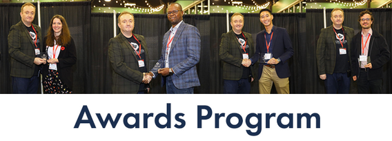
Canada’s National Geomatics Expo Awards are a great opportunity to recognize the people and organizations making a difference in the geomatics field. Whether it’s groundbreaking technology or strong leadership, these awards celebrate the achievements that are pushing the industry forward. This year, the nominees were chosen by the public, and now it’s your turn to make your voice heard. You can vote across all categories or select only the ones you’re interested in. You are limited to
A presentation on the latest advancements in construction technology. The session will begin with an introduction to key concepts such as Visual Intelligence and Reality Capture, and a quick look at how construction tech has evolved. The presentation will also include discussions on the use of Visual Intelligence and Reality Capture in construction, with real-world examples from platforms like Timescapes, Cupix, Buildots, and DroneDeploy. Attendees will learn about the challenges and solution...
Earth Observation technologies have experienced unprecedented innovation and accessibility over the past several years. The role of the commercial sector has stepped in to offer several capabilities historically only available from government. This session will focus on examples of how EO technology is being...
Reduced snowpack in the Rockies presents a severe drought risk for Southern Alberta. Mountain snowmelt in the Bow and Oldman basins maintains reservoir levels, crop irrigation, municipal and industrial supply, and ecosystem services. As climate and consumption pressures increase, accurate snow water equivalent (SWE) data is crucial for water supply forecasts, which impact allocations and emergency drought measures. Field snowpack monitoring does not provide accu...
For the built environment, digitalization is a key sustainability enabler. It helps stakeholders across the construction sector increase productivity and transparency while reducing emissions, resource consumption and costs, and adding digital tools that can help companies establish and optimize their sustainability performance.
In our rapidly evolving urban landscapes, inadequate accessibility maps leave many people with disabilities facing significant challenges. This talk begins by illustrating the problem with real examples of accessibility fails on platforms like Google Maps. Attendees are encouraged to check accessibility features on their phones, highlighting current gaps.We will then explore the necessity of specialized tools for meaningful navigation and destination planning for people with disabiliti...


